The Tizi n’Tichka is the mountain pass on the N9, the main road connecting Marrakech to Ouarzazate and everything beyond it — Ait Ben Haddou, the Dades and Todra valleys, and the routes on to the Sahara. At 2,260m, it’s the highest paved road pass in Morocco open year-round, and for decades it had a reputation for being genuinely hair-raising: narrow, poorly barriered, choked with slow-moving trucks on the steepest switchbacks.
That reputation is now out of date in the specific sense that the road has been substantially widened and resurfaced, with better crash barriers and a more forgiving surface than it had even a few years ago. It is not out of date in the sense that this is somehow now a fast, casual drive — it’s still a real mountain crossing, and treating it otherwise is how people end up rushing a road that doesn’t reward rushing.
| Where | On the N9 between Marrakech and Ouarzazate, summit at 2,260m |
| Cost | Free to drive; roadside stalls and cooperatives set their own (often inflated) prices |
| Time needed | 2.5-3 hours from Marrakech to the summit; around 4 hours total to Ouarzazate |
| Getting there | Self-drive, grand taxi, or as part of any guided tour heading south |
| Best time | Daylight hours, April-October; check conditions in winter before travelling |
Real drive times, not marketing figures
It’s worth being blunt about this because plenty of tour listings and older travel advice understate it: even with the improved road surface, Marrakech to Ouarzazate over the Tizi n’Tichka takes around four hours in normal conditions, not the two-and-a-half to three hours sometimes advertised. The pass itself, from the edge of Marrakech’s outskirts to the summit, is a genuine 2.5 to 3-hour climb through tightening switchbacks, regardless of how good the tarmac is — physics and geography don’t move for road resurfacing. Add stops for photographs, tea or roadside browsing and a half-day is a realistic total for the one-way crossing.
A guided Tizi n’Tichka tour with an argan oil visit is a sensible way to do the crossing for a first-timer, since a local driver knows the road, the reliable stopping points, and how to pace the drive rather than pushing straight through.
If you are weighing whether to drive yourself or hand the wheel to someone else, the guide to driving in Morocco covers the practical side, and guided tour versus independent travel lays out the trade-offs honestly. For this particular road, the deciding factor is usually how you feel about hairpins and slow trucks rather than about money. A confident driver with a full day and no fixed arrival time will enjoy the pass at their own pace; anyone who wants to look out of the window instead of at the bumper in front is better off sitting in the back.
The shape of the day matters as much as the road. Leaving early gives you the climb in clean morning light, room for unhurried stops, and a margin if the traffic behind a lorry turns out slower than expected. Leaving late turns the same crossing into a race against dusk, and that is the single most common way people sour what should be one of the best drives in the country.
What’s changed on the road
Major resurfacing and widening work over recent years has removed some of the pass’s worst pinch points — sections that used to be single-lane-effective with trucks and buses forced to negotiate passing space have been widened, and barrier coverage on the steepest drops is considerably better than it was. The net effect is a genuinely safer drive, with less white-knuckle truck-passing than the road’s older reputation suggests. It is still a mountain road with tight hairpins, occasional rockfall debris, and, in winter, the real possibility of snow and ice near the summit — this isn’t a road to underestimate regardless of how good the surface has become.
What the landscape does as you climb
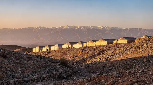
The pleasure of the Tizi n’Tichka is in the transitions. You leave the plain around Marrakech behind, the road starts to tighten, and the vegetation thins as the slopes turn to bare, wind-scoured rock. Colour changes too: reds, ochres and greys replace the greens of the lower valleys, and once you are over the summit the pre-Saharan south announces itself in earth-coloured villages and dry riverbeds. Because the scenery shifts so gradually, passengers often realise only at the top how far the landscape has moved from where they started.
This is also why the pass pairs so well with the wider High Atlas region. If the mountains appeal more than the destination at the far end, the Atlas Mountains day trip guide and the Imlil guide offer other ways into the same range, on foot rather than through a windscreen.
Roadside stops and the argan oil question
The Tizi n’Tichka is lined with roadside stalls selling geodes, fossils, carpets and, most persistently, argan oil — and it’s worth knowing that many of these are commission stops, where drivers and guides receive a cut for bringing tour groups in, rather than genuine women’s argan cooperatives. That doesn’t make every stop a scam: some are legitimate, and a good guide will know the difference and can steer you towards a real cooperative rather than a tourist-pricing showroom. If argan oil specifically interests you, it’s worth reading up on how to spot genuine product before buying anywhere on this route, roadside or otherwise.
Viewpoints along the ascent, particularly in the upper switchback sections, offer genuinely worthwhile photo stops with the Atlas ranges stretching in every direction — these cost nothing and are worth building time for, separate from the commercial stalls. A guide to spotting genuine argan oil is worth reading before you set off if you plan to buy anywhere along this route, roadside or otherwise, since adulterated product mixed with cheaper sunflower or other vegetable oil is common enough to catch out anyone shopping on price alone.
A useful rule for any roadside stall: decide before you stop what, if anything, you actually want to buy, and be comfortable saying no and walking back to the car. Prices are rarely fixed, so the same haggling habits that work in the medina apply here, and the scams guide is worth a skim if you have not been to Morocco before. None of this needs to feel confrontational; a polite refusal and a smile is usually all it takes.
Berber villages along the route
The N9 passes through a string of small Berber villages on both sides of the summit, built from the same earth and stone as the surrounding hills, with terraced fields wherever the slope allows cultivation. Most are easy to miss at speed but worth a slower look if you have the time: flat-roofed houses stacked up the hillside, mosques marked by simple square minarets rather than anything ornate, and, on market days in the larger villages, a genuine local souq rather than one aimed at passing tourists. Stopping in one of these villages for tea, rather than only at the commercial roadside stalls, is a more honest way to put money directly into the local economy along the route.
If village life is what draws you, the guide to Berber village visits explains how to be a good guest, from asking before photographing people to choosing a family-run place for tea. The same courtesy applies on the pass: a few words of greeting and a little patience go a long way, and you will almost always be met with more warmth than the commercial stalls suggest.
Combining the pass with a stop at Telouet
A signed turn-off partway along the N9 leads to Telouet, the Glaoui family’s mountain kasbah, a worthwhile detour for those with the extra hour and interest in the region’s history rather than a straight Marrakech-to-Ouarzazate push. A day trip combining the UNESCO kasbahs and Telouet’s green valley builds this in without requiring you to navigate the detour yourself.
Where the pass leads
Crossing the Tizi n’Tichka is rarely the point of the trip; it is the way to something else. The most popular destination is Ait Ben Haddou, and the Ait Ben Haddou guide explains what to see once you arrive. Many travellers combine it with Ouarzazate, covered in the Ouarzazate day trip guide, and some choose a day out taking in the famous kasbah and the film studios so that the driving is handled for them.
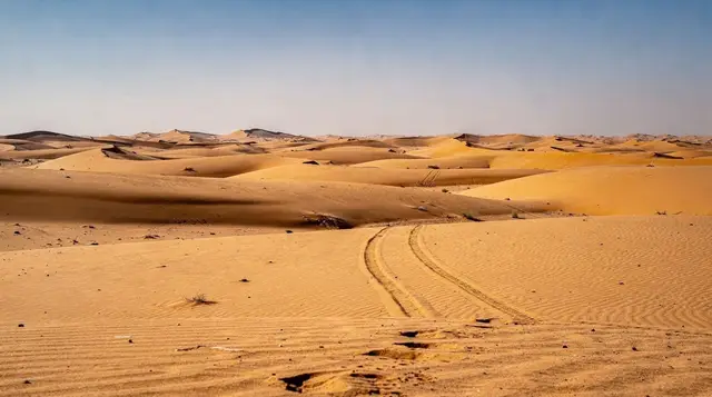
Beyond Ouarzazate, the road continues to Skoura, the Draa Valley, the Dades Valley and on to Merzouga and the dunes. If the pass is the first leg of a longer journey, the Marrakech to Merzouga guide and the southern circuit itinerary show how the pieces fit together, while the Sahara in three days plan is the shorter version. For a gentler option, the two-day Atlas itinerary keeps the mountains without the long haul south.
Practical notes
Fuel stations exist along the route but are more widely spaced than on Morocco’s main highways, so it’s sensible to fill up in Marrakech or at one of the larger villages en route rather than relying on finding one exactly when needed. Mobile signal is patchy through the highest sections. If self-driving, check weather conditions before setting out between November and March, when snow at the summit can slow or occasionally close the pass; local news and hotel staff in Marrakech are reliable sources on current conditions.
Dress for the mountains rather than for the city you left that morning. Layers are sensible because conditions at the top can differ noticeably from the plain, and the what to wear guide and the winter guide help you pack for the season. If you are travelling with children, the same four hours that feel manageable to adults can feel long in the back seat, so build in a few proper breaks and read the family activities guide for ideas on keeping the day light. Motion sickness on switchbacks is common enough to be worth planning for.
If you would rather not drive at all, the guide to trains and buses in Morocco explains the public options, and the best day trips from Marrakech puts this crossing in context against the alternatives. For a longer read on why the south repays the effort, the blog piece on what nobody tells you about the Sahara is a good companion.
A short history of the road
The current N9 alignment over the Tizi n’Tichka dates from the French protectorate period, built in the 1920s to open a reliable motor route between Marrakech and the south, replacing the older mule and caravan tracks that had crossed the range for centuries further west, closer to Telouet. Before this road existed, crossing the High Atlas to reach Ouarzazate and the pre-Saharan trading towns was a multi-day undertaking on foot or by pack animal, which is worth remembering when a modern four-hour drive starts to feel slow: it’s a fraction of what the same crossing demanded for most of history.
The pass has been resurfaced and widened in stages since, most recently as part of a broader push to improve safety and travel times on Morocco’s mountain highways, reducing what was once a genuinely risky crossing to a manageable, if still demanding, day’s drive.
Coming back over the pass
The return crossing, Ouarzazate to Marrakech, follows the same road and takes broadly the same time, though many travellers find the descent into Marrakech’s plain in late afternoon light particularly striking after several days in the drier, more austere landscapes further south. If you’re on a multi-day southern loop, budget the same four hours for the return leg as you did outbound — there’s no shortcut on the way back, and arriving into Marrakech traffic in the early evening rather than after dark is generally the more comfortable choice.